|
|
|

|
|
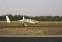
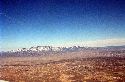
N724X takes wing for the first time and the skies opened to explore! The December day in Melbourne, Florida was perfect! 12/9/01
|
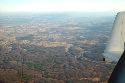
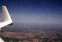
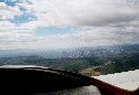
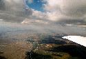
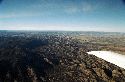
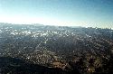
Picture taken on our third flight, high above Melbourne Airport (MLB)
|
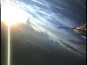
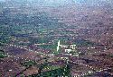
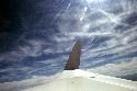
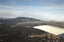
The wispy clouds give a surreal feel to the scene. 12/10/01
|
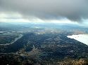
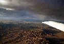
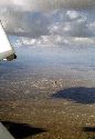
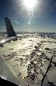
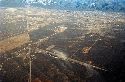
Over the deck covering the northern part of Florida on the way home for the first time. Glorious! 1/2002
|
|
|
|
|
|
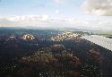
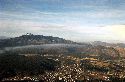
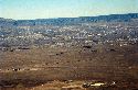
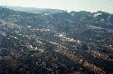
After overnighting in La Grange, GA, this vista greets us as we climb out from LGC. 1/2002
|
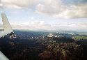
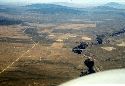
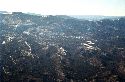
Gadsen, Alabama passes alongside as we wing towards the Midwest. 1/2002.
|
The rolling hills of Tennessee pass underneath. Maury Count, the airport from which I first flew 2 years before is seen in the distance. 1/2002
|
A very angry Athena Guerra glares at me from the backseat. Along with my remaining belongings and a few houseplants, she and I are about to embark upon our escape from Iowa City.
|
|
|
|
|
|
On the way to Albuquerque - we pass by Ottumwa, IA (OTM). The flatlands of the midwest are a tremendous contrast to what is to come.
|
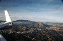
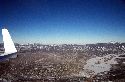
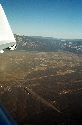
Somewhere over Kansas. The landscape changes dramatically as we travel West.
|
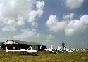
At Airventure 2002 amongst a gathering of canards.
|
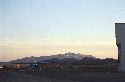
Home base! Santa Fe Municipal (SAF)
|
|
|
|
|
|
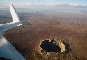
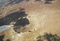
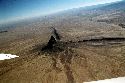
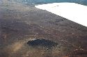
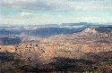
Meteor Crater, near Winslow, Arizona 9/2002
|
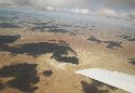
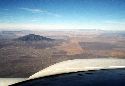
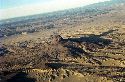
Arizona desert, returning from California to NM.
|
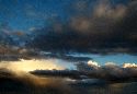
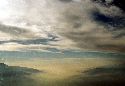
Light from the setting sun plays on looming clouds, a spectacular sight! Somewhere over Arizona.
|
More Meteor Crater
|
|
|

|
|
|
|
Approaching Sedona, Arizona. 9/2002
|
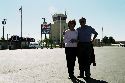
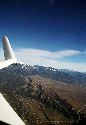
Dad basks in the sun at Sedona (SEZ). The famous red rocks loom behind. 9/2002
|
|
|
|
|
|
|
The infamous Banning Pass. We are passing over Palm Springs in clear swparkling sun. The LA basin lies beyond - you can see with what the basin is filled as it 'oozes' out the pass towards Palm Springs. We fly over it as long as we can before descending into the murk. 9/2002
|
The setting sun's rays glow on N724X as we taxi in to Corona Municipal (AJO) 9/2002
|
Returning over the desert of California into Arizona.
|
The Ford Company proving grounds
|
|
|
|
|
|
The red rocks of Sedona once more 9/2002
|
|
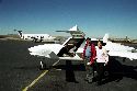
My parents, Ricardo Sr. and Inez, stand next to our plane, having just arrived at Farminington Regional, NM. (FMN) 10/2002
|
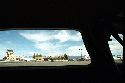
Control tower and FBO at Farmington. Had a great luch at the resourant on the field, Senor Pepper's, well worth the trip.
|
|
|
|
|
|
Shiprock, sacred to the Navajo, northwestern NM, near Farmington. 10/2002.
|
|
We enjoy the delicate beauty of high cirrus clouds
|
The bridge over the Rio Grande gorge near Taos, NM. 11/2002
|
|
|
|
|
|
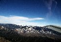
Tracking from nothern New Mexico into Colorado, near Alamosa. 11/2002.
|
Taos, New Mexico
|
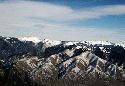
The Sangre de Cristo Mountains, near Taos, NM. 11/2002.
|
|
|
|
|
|
|
Durango, La Plata airport (DRO) 12/2002
|
On final for Durango.
|
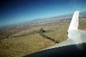
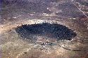
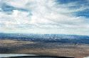
11/30/03 - Traveling to Kingman, AZ to visit my friend, Malcolm Hart of 'An Oshkosh Miracle' fame. He and his Cozy III, N296MH, have moved there along with wife, Doris, and OSH Miracle parakeet, Elvis. Once more passing above Meteor Crater, outside of Winslow, AZ. Traveling along V291 at 12,500 feet. A beautiful, smooth day, in spite of 30+ knot headwinds slowing us down.
|
The tiny cars and buildings along the rim give a sense of the size of the crater.
|
|
|
|
|
|
The Crater falls behind as we ride westward.
|
As I passed Flagstaff, ABQ Center called out traffic to me, a C130 approaching from behind at 12,000 feet. The C130 crew wanted to know how fast "the little guy" was moving. With the headwinds, I was making only 150 knots groundspeed. Even so, not bad considering I was working with only a single 260HP engine versus their four 4500HP engines. As expected, they soon caught up and passed me. Seen loafing by just under my canard, probably making only 200 or so knots. Even though it looks small here, it was quite a sight! Almost 100 long with a wingspan of over 132 feet - I should have offered to trade a ride in my plane for one in theirs!
|
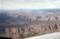
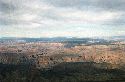
From Flagstaff, rather than flying direct, I trundled along V291 to Peach Springs (PGS) located on the edge of the Grand Canyon. From 12500, you can start to get an inkling of the immensity of the canyon.
|
Even the very edge of the park is spectacular as I approach the VOR.
|
|
|
|
|
|
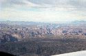
More views of the Grand Canyon as I start to descend in preparation to landing at Kingman.
|
|
|
Last glimpse of the canyon at Peach Springs VOR as I'm about to turn southwest to descend into the valley in which Kingman resides.
|
|
|
|
|
|
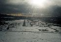
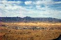
Kingman, AZ airport (IGM)
|
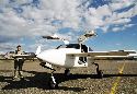
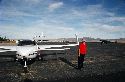
Malcolm Hart inspects N724X.
|
After a nice but too brief visit in Kingman, N724X and I return home. Here, we travel along at 11500 feet over Flagstaff. The headwinds I had dealt with traveling out had virtually completely died out, leaving < 10 knots extra push to get back to SAF.
|
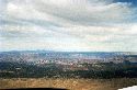
The city, set at the foot of Humphreys Peak, is gorgeous.
|
|
|
|
|
|
As Flagstaff rolls by underneath my swept wing, I enjoy the shifting light of a setting sun highlighting the stark Arizona desert. The air becomes almost still as night falls. The lights of Albuquerque and Santa Fe are a welcome sight as we cross the inky darkness of the desert. A trip of over 400 nautical miles across spectacular landscapes in a little over 2.5 to 3 hours each way. Another great trip!
|
January 2004 - a local flight around the Albuquereque area. Tracking southwards to a point about 50 miles west of Socorro, one comes across a strange sight: 27 radio antennas in a Y-shaped configuration on the Plains of San Agustin. These antennas form an astronomical radio observatory. Each antenna is 82 feet in diameter. The data from the antennas is combined electronically to give the resolution of an antenna 22 miles across, with the sensitivity of a dish 422 feet in diameter. For more information (and lots of really cool pictures), see the VLA web site: http://www.vla.nrao.edu/
|
Returning towards Albuquerque, one crosses over the Gallinas Mountains which form the northern boundary of the Plains of San Agustin.
|
As one tracks due north from the Gallinas Mountains, you reach Mount Taylor and the San Mateo Mountains. At the northeast end of the range, one finds this outcropping of rock named 'Cabezon'. It's located at the intersection of V187 and V62-263 named appropriately enough, CABZO.
|
|
|
|
|
|
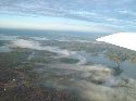
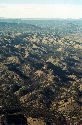
The interesting textures of the terrain west of Albuquerque.
|
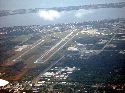
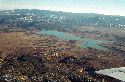
Double Eagle II airport (KAEG) located on the west mesa. The Rio Grande River and the City of Albuquerque itself are seen beyond. ABQ Sunport airport is just seen in the upper right side of picture. The last few pictures were taken on the same brief jaunt - it was a really beautiful day!
|
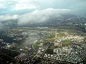
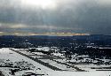
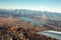
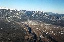
3/7/04 - After stopping in at the avionics shop at AEG, I embark on a shakedown cruise. After lifting off from AEG, I fly along parallel to the Rio Grande River. The last snowstorm of the year dumped a beautiful layer of snow on the Sandia Mountains, seen in the background. Albuquerque lies at the foot of the mountains. My home is located roughly center picture just at the base of the mountain.
|
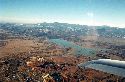
Cruising northward, past Santa Fe, we cross by Los Alamos. Looking westward, you can see the the town of White Rock (lower left). Los ALamos airport (LAM) is seen center right on the mountainside.
|
|
|
|
|
|
The airport and the town of Los Alamos. Note the canted angle of the airport requiring landings uphill and takeoffs downhill.
|
KLAM - The restricted area, R-5101, lies off to the left of the airport, encompassing the lower left corner of the picture.
|
Circling around Abiquiu Resevoir. The flat-topped mountain seen top right was made famous by artist Georgia O'Keefe
|
|
|
|
|
|
|
|
Tracking into Colorado over the plains just south of Alamosa.
|
|
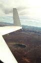
La Veta Pass - As the day draws to a close, we turn back to Santa Fe. La Veta Pass is a dip in the mountain range that allows easy crossing over to the east side of the range. The road seen below the winglet snakes through the pass. Pueblo, Colorado lies beyond and Denver is not far past that. Crossing the pass will have to wait for another day as we turn for home.
|
|
|
|
|
|
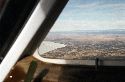
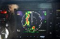
A nice feature of the MX20 MFD: terrain mapping. This picture was taken right after the one previous. La Veta Pass can be seen as a gap in the mountain range. Black signifies terrain greater than 2000 feet below with green and yellow showing terrain closer to the plane's altitude. Red is at or above the plane's current altitude.
|
Taos, New Mexico once more.
|
Taos Airport (SKX). If you look REALLY closely, you can see Julie Roberts next to the FBO, waving vigorously 'at that really cool plane' ... and then I woke up.
|
Taos slides by underneath as we wing home to Santa Fe - a two hour drive takes less than a half hour by air!
|
|
|
The sun sets after a great jaunt (3/7/04). After putting N724X to bed, I enjoy the view from my hangar as twilight gathers over the Sierra Nacimiento.
|
 Comments, questions, and suggestions are welcome! email: rich@rguerra.com